Welcome

Dear readers,

Welcome to my natural hazards blog! I post regularly about any natural hazards going on around the world on a day-to-day basis.

Enjoy!!

A

Saturday 12 December 2015

Idaho Earthquakes


More than 40 small earthquakes have been recorded in East-Central Idaho this week (Monday 7th- Sunday 13th December). Experts say this is another earthquake swarm in the region.The earthquakes started on Tuesday and have mostly gone unnoticed or unreported in an area experienced with more vigorous shaking.
 
However, officials in the Challis area reported no damage from the micro-earthquakes on Friday 11th December 2015.
 
The earthquakes ranged up to 2.9 magnitude, and scientists are trying to find the fault system in the area, where a 5.0 magnitude earthquake struck in January.
 
 
William Phillips, a research geologists from the University of Idaho says scientists are not sure if these earthquakes and tremors could lead to something bigger.
 
 
Mount Etna eruption
 
 
The world's most active volcano has erupted after two years. The eruption lit up the night sky over much of eastern Sicily late on Saturday night and into the early hours of Sunday. It has been erupting for four days, with lava flowing down the side of the mountain, and hot ash clouds being spewed into the air.


The plume of ash rising from Mount Etna can be seen across much of eastern Sicily.The nearby Catania airport has now been reopened after it closed on Friday when ash clouds caused safety concerns.
 
Mount Etna is Europe's tallest active volcano, and is located in Sicily. It has erupted many times during history and is still active. Italian authorities have used explosives, concrete dams and ditches to divert  the lava flow from the surrounding settlements. However, the latest lava flow did not endanger any houses, and no evacuation was ordered.


Wednesday 9 December 2015

Storm Desmond
 
In Cumbria and Lancashire more than 43,000 homes are suffering from power cuts, while an estimated 5,200 homes have been affected by flooding. The storm claimed 2 lives; one in Cumbria, and one in the Northern Republic of Ireland. 5.9 inches of rain poured down in only 30 hours. Bridges collapsed, 40 schools were closed, and the government issued 15 severe flood warnings across the country.
Storm Desmond flooded parts of Northern Ireland, north Wales, Southern Scotland and especially North-west England over the weekend, and more heavy rain is expected this week.

Record-breaking amounts of rain fell in Cumbria, the worst-hit county. Many criticised the government after the multi-million flood protection that they installed in Cumbria in 2005 failed to prevent further disasters from happening.


8 rescue centres were opened to the public and life boat crews and military personnel were dispatched.
Storm Desmond


Developments:

Electricity North West said power had been restored to 1,200 customers in Cumbria, however more than 1,450 remain without power.

Why is the UK getting hit by severe storms and flooding?

Storm winds bring warm water across from the Atlantic Ocean. These waters start to form a storm, as a result of high temperature waters, the Coriolis effect, and condensation. The storm moves over the warm waters, collecting water vapour, and causes devastation when it hits land.


Friday 4 December 2015

Hurricane Sandra

On Monday 23rd November Hurricane Sandra hit the southern Gulf of California. On its journey North, it was close enough to drop more than 2 feet of rainfall along part of the coast of Western Mexico. However, Sandra remained well off the western Mexican coast during the most dangerous period, November 25-27, 2015. It was a very powerful hurricane with sustained winds of up to 130 knots, or 150 mph.
 
An analysis created by NASA's Goddard Space Flight Centre in Greenbelt, Maryland showed that much of Sandra's rainfall occurred over the open waters of the Eastern Pacific Ocean. The analysis also shows moisture flowing from Hurricane Sandra also caused heavy rainfall totals of over 700 mm (28 inches) in an area northeast of Puerto Vallarta, in Mexico.
 
On Thursday morning, 26th November 2015, Sandra was recorded to be the latest Category 4 hurricane in either the eastern Pacific or Atlantic basins. The previous Category 4+ tropical cyclone  in either the Eastern Pacific or Atlantic basins was Hurricane Kenneth, in 2011.

The unseasonably late storm could have inflicted significant damage to the agricultural region's maturing crops. It was expected to bring power cuts, a strong storm surge and flooding. However it became a Category 3- hurricane when it reached land.

 
Before Sandra rapidly weakened, it became an unusually strong hurricane for so late in the tropical season. Sandra eventually died down on 29th November, after becoming only remnants of its powerful self on 28th November.
 
Interesting fact:
A 3D looking of the storm, produced by a drone, showed that Hurricane Sandra actually had 2 eyes.
 
 
 An aerial photo showing the movement of the forming
hurricane and the eye, or epicentre.


Monday 19 October 2015

Typhoon Koppu in the Philippines
Sunday 18th October 2015


The lowdown: On Sunday morning a huge typhoon, called Typhoon Koppu, hit near the island of Luzon, in the Philippines. The typhoon brought winds of about 200km/h. The typhoon is up to 650km across and is very slow moving, say the BBC.More than 15,000 people have been forced to evacuate their homes, with more expected in the next few days. A teenage boy was killed, and four others injured when a tree fell on top of houses in Manila. People in the worst hit areas have to be able to sustain themselves with enough food and water for up to 72 hours. Flights, bus and ferry services in the north have been cancelled for fear of landslides. Aid agencies have already distributed emergency supplies to evacuation centres while the Philippine military in Northern Luzo has been placed on alert for disaster operations. Typhoon Koppu is not due to leave the Philippines until Tuesday, when it will start heading towards Taiwan.


What is a typhoon?

A typhoon is a type of large storm with a spiral system of violent winds. A typhoon/hurricane/cyclone generally has winds stronger than about 120 kph. It is typically hundreds of kilometres or miles in diameter. 

Whats the difference between a cyclone and a typhoon?

There is no difference between a hurricane, a cyclone and a typhoon. They are all different names for the same kind of intense low pressure storm system.
In  the Western Pacific, near Asia, they call tropical cyclones "typhoons." In most of the southern hemisphere and the Indian Ocean, they simply call tropical cyclones a "tropical cyclone."


Saturday 10 October 2015


Floods in Southern France
3rd October 2015
 
The lowdown: Violent storms and flooding hit south-eastern France on Saturday. 17 people have been killed and 4 more are missing. Meteorologists issued a warning, but no one expected that the storms would dump nearly 200 litres of rain per square metre in less than three hours on an area between Nice and Cannes. The rainfall total was the equivalent of two months of downpours in the area. The areas worst-hit by flooding were also the hardest to access, officials said, raising fears the death toll could rise again. About 27,000 homes remained without power Sunday morning, 14,000 of them in Cannes alone. The flooded streets stranded many vehicles made numerous trees fall over. Forecasters at France's weather agency said the worst storms had now passed over the French mainland and were headed for the Italian coast. French President Francois Hollande announced a state of "natural disaster" in the affected regions.
 
 
Flooding in Cannes

Flooding at the local train station in Cannes
Train stations were completely flooded with water, disrupting public transport for those coming in and out of the affected cities.
 

Saturday 26 September 2015

Sierra Nevada Wildfire

The lowdown :A record drought in California has set a perfect climate for wildfire season, creating a record number of fires, as well as their size and destruction. The fire, burning over 70,760 acres in Amador and Calaveras counties, was 65% contained as more than 4,000 firefighters sought to prevent its spread. Over 500 homes have been destroyed and 2 deaths have been reported.


Californian drought

California is entering the fourth year of a record-breaking drought creating an extremely dry landscape. Governor Jerry Brown declared a drought State of Emergency in January 2015. About 12 million trees have died in California forestlands in the past year because of the drought. The drying landscape is increasingly threatened by large, intense wildfires. Researchers found that although was caused by natural variation in rain and temperature, climate change added between 8% and 20% to the effect of the drought. This is a warning that as climate change gets worse the effects of drought around the world will also be worse.


The Enterprise Bridge passes over full water levels at a section of Lake Oroville in Oroville, California, 2011. The right hand picture shows the drop of the water level of the lake in 2014. 


Saturday 19 September 2015


Earthquake in Chile


So... first post of the blog! The topic is going to be the huge earthquake that struck Chile on Wednesday 16th September.


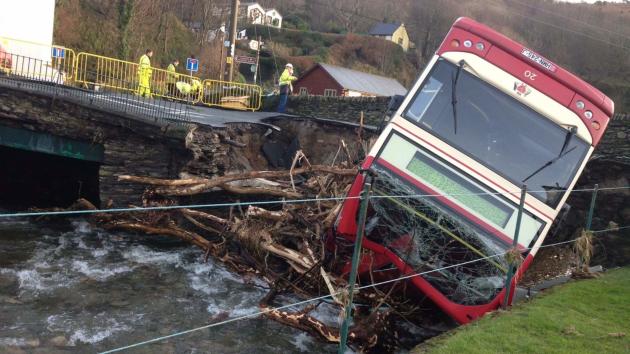
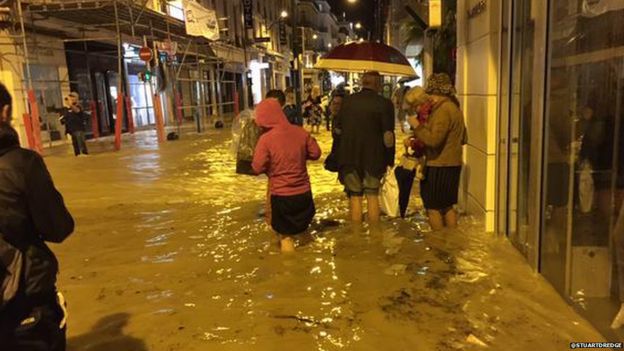
The lowdown: On the 16th September 2015 a very powerful earthquake struck off the coast of Chile. Over a million people were evacuated from coastal areas and at least 11 people were killed. Chile's government has declared a state of emergency in the central region of Coquimbo. Illapel, an inland city with about 30,000 residents was reported immediately to be without water. Two days after the earthquake 90,000 people were still without electricity.The earthquake had a magnitude of 8.3, the strongest this year, and has sent tsunami waves as far as Japan! It was the country's sixth most powerful recorded earthquake. The earthquake struck as many of Chileans were travelling to the coast to spend a week of celebrations for their independence day. Illapel, an inland city with about 30,000 residents was reported immediately to be without water. Two days after the earthquake 90,000 people were still without electricity.


The USGS (US Geological Survey) said that  the tremor struck off the coast of Coquimbo, 46km (29 miles) west of the city of Illapel at 19:54 local time (22:54 GMT). 
The USGS said it was at a depth of 25km, while Chilean seismologists calculated its depth at 11km.

How do earthquakes happen?

Earthquakes happen when tension is released from inside the Earth's crust. Tectonic plates do not always move smoothly alongside each other and sometimes get stuck. When this happens pressure builds up and is eventually released. This is when an earthquake tends to occur.


This map shows the seismic zones around the world. The seismic scale goes from 1-9, 9 being the zone at the highest risk of plate movement. Chile is in the red area, showing that it is at high risk of earthquakes and volcanos.